Before GPS, America's Highways Were Total Chaos: The Bureaucratic Battle That Finally Made Road Trips Possible
When Every State Spoke a Different Highway Language
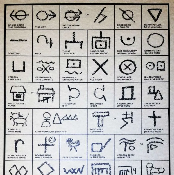
Imagine planning a cross-country drive where Route 30 in Pennsylvania becomes Route 6 in Ohio, then transforms into the Lincoln Highway in Illinois, only to disappear entirely at the Iowa border. This wasn't some dystopian nightmare—it was American highway travel in the 1920s, when every state designed its own road signs with zero coordination.
Drivers carried stacks of conflicting maps, guidebooks that contradicted each other, and prayer that they'd somehow end up where they intended. The chaos was so complete that the American Automobile Association employed teams of scouts whose only job was figuring out which roads actually connected to which other roads.
The Wild West of Road Naming
Before federal intervention, American highways were branded like competing businesses. The Lincoln Highway stretched from New York to San Francisco, but so did the National Old Trails Road, the Yellowstone Trail, and dozens of other named routes that overlapped, intersected, and sometimes ran parallel for hundreds of miles.
Each route had its own promotional organization, complete with distinctive markers, painted telephone poles, and roadside advertising. Driving the Lincoln Highway meant following red, white, and blue stripes painted on utility poles. The Dixie Highway used distinctive yellow and black signs. The Jefferson Highway marked its path with blue and white posts.
States made it worse by creating their own numbering systems. New York's Route 5 had nothing to do with Pennsylvania's Route 5. Some states used letters instead of numbers. Others created elaborate symbols that meant nothing beyond their borders.
The Meeting That Almost Failed
By 1925, the chaos had reached a breaking point. The newly formed American Association of State Highway Officials (AASHO) called a meeting to create some kind of national system. What happened next was less collaboration than bureaucratic warfare.
State highway officials arrived in Washington D.C. with their own agendas and zero interest in compromise. New York wanted to keep its existing numbering system and force everyone else to adapt. California insisted that any transcontinental routes should start and end on the West Coast. Texas demanded that its state highways take precedence over any federal system.
The meeting nearly collapsed on day two when Michigan's representative walked out, declaring the whole effort "impossible and unnecessary."
The Genius of Even and Odd
The breakthrough came from an unlikely source: E.W. James, a relatively junior official from the Bureau of Public Roads. While the state representatives argued about prestige and politics, James was quietly working on a mathematical solution.
His idea was elegantly simple: number highways based on their direction and importance. East-west routes would get even numbers, starting with the most southern routes. North-south routes would get odd numbers, beginning in the west. The most important transcontinental routes would be multiples of 10.
This meant Route 10 would run along the southern border, Route 90 along the northern border. Route 1 would follow the East Coast, Route 101 the West Coast. Three-digit numbers would indicate shorter routes connecting to the main highways.
The Compromise Nobody Wanted
James's system was logical, but it trampled on state pride everywhere. Under his plan, the famous Lincoln Highway would become multiple different numbers as it crossed the country. New York's cherished Route 1 would be renumbered. California's scenic coastal highway would get a three-digit designation.
The resistance was fierce. State officials complained that tourists wouldn't understand the new system. Highway associations threatened lawsuits. Local chambers of commerce worried that losing their named routes would hurt tourism.
But James had one powerful ally: the automobile industry. Car manufacturers and oil companies were spending millions on highway maps and travel guides. The current chaos was costing them money and customers. When Henry Ford publicly endorsed the numbered system, state resistance began to crumble.
The System That Stuck
The compromise reached in November 1926 wasn't perfect, but it was workable. States could keep their named highways for tourism purposes, but federal funding would only go to roads that adopted the new numbering system. Most importantly, all highway signs would follow consistent design standards.
The rollout took three years and cost millions of dollars in new signage, but the results were immediate. For the first time in American history, a driver could navigate from coast to coast using a consistent, logical system.
Route 66 became America's most famous highway not because it was the most important, but because its number was easy to remember and market. The east-west even numbers and north-south odd numbers became so ingrained in American culture that we still use the same logic for Interstate highways today.
The Legacy of Bureaucratic Genius
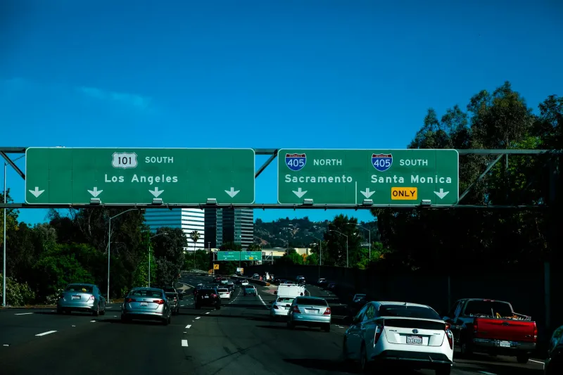
Ninety-seven years later, James's numbering system remains one of the most successful examples of federal standardization in American history. We've added Interstate highways, created bypass routes, and built urban loops, but they all follow the same basic logic: even numbers go east-west, odd numbers go north-south, and the most important routes get the lowest numbers.
What started as a bureaucratic nightmare became the foundation for American mobility. Road trips, interstate commerce, and even the Interstate Highway System all built on the framework created by a handful of officials who managed to find compromise in chaos.
The next time you merge onto I-95 or follow Route 101 up the California coast, remember that you're navigating with a system that almost didn't exist—saved only by the determination of bureaucrats who refused to let American highways remain forever lost in translation.